
What is It?
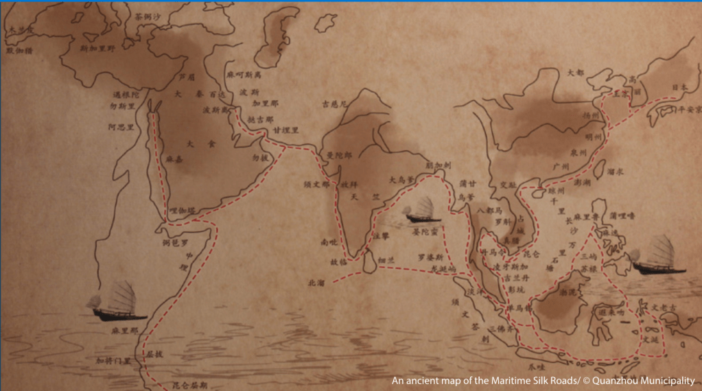
This is an ancient map of maritime silk trade routes. It shows the port cities written in Chinese and the trade routes that link them. From this map, you can see that maritime trade included East Africa, the Middle East peninsula, the Indian subcontinent, Southeast Asia, the Indonesian archipelago, East China, Japan, and Korea. This map also has illustrations of the merchant junk ships that Chinese merchants used. Unfortunately, the creator and the year this map was created are unknown.
Interesting Tidbits
From this map, you can tell which countries were close to and which countries were far from Quanzhou. Because of this distance, you can see why the Muslim merchants from Far West decided to stay in Quanzhou, and at the same time, you can see why Southeast Asia was a popular trade route for Chinese merchants.
Connection to Guiding Question
This map can be used to explain why Quanzhou became a prime port city during the Song and Yuan dynasties. From this map you can see that it was close to sea and located between trading partner, such as the Korea, Japan, Vietnam, and Indonesia. In addition, this map also shows the location where the foreign merchant communities originally came from and where the Chinese merchants went when they traveled on the merchant ships built in Quanzhou.
Municipality of Quanzhou. (n.d.). An Ancient map of the Maritime Silk Roads [Illustration]. UNESCO. https://fr.unesco.org/silkroad/sites/default/files/styles/silkroad_colorbox/public/ map_pf_quangzhou_maritime_silk_roads_5.jpg?itok=D3Aoc64K

 My Content Resources